The Flight Information Centre officer was correct, we'd arrive just ahead of an incoming front.
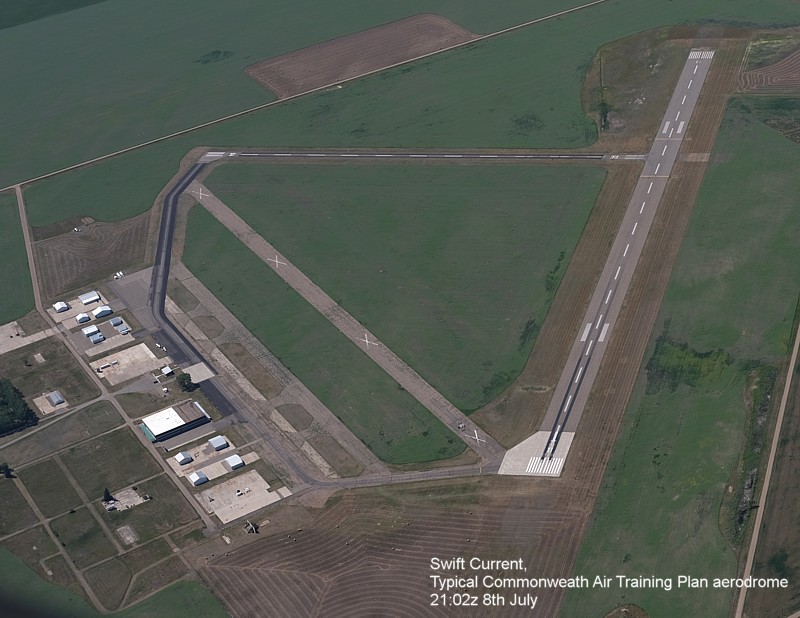
The Flight from Oshawa to Boundary Bay
First Leg
The Flight Information Centre officer was correct,
we'd arrive just ahead of an incoming front.
When I fly across Canada I fly across time zones, and so all times are in GMT (UTC) and appended with a 'z'.
Takeoff Oshawa at 17:04z, Land:
18:06z. 1 hour 2 minutes in the air. 107.6 litres of fuel was added before
takeoff, and I can't remember how much we added at Wiarton.
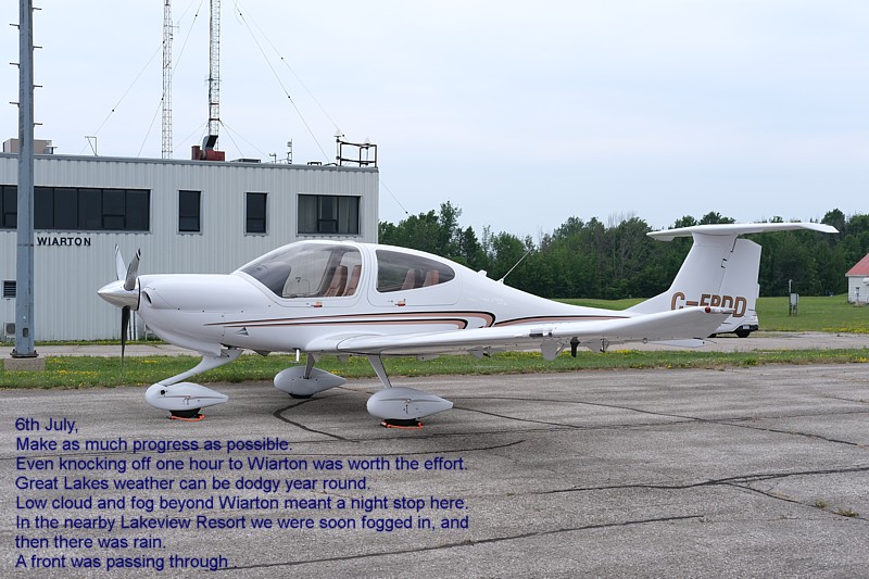
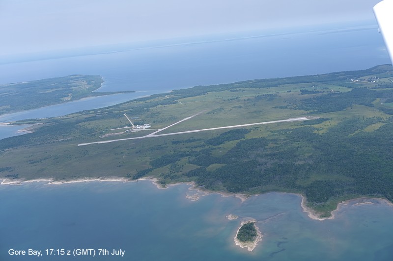
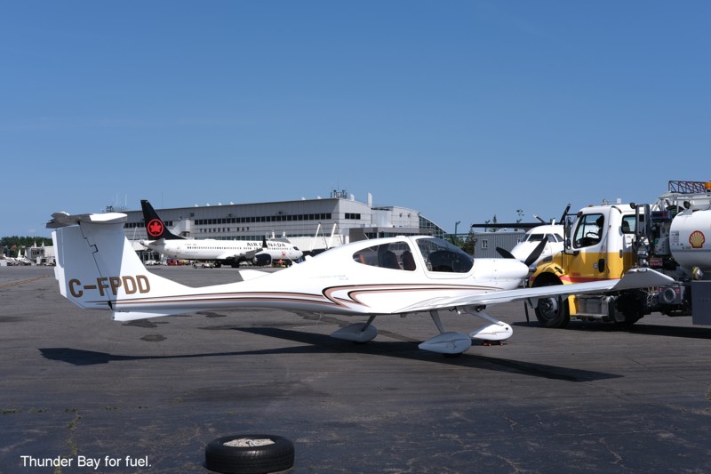
Wiarton to Winnipeg via Thunder Bay
Johnny got out of bed early and walked to Tim Hortons to pick up
breakfast.
The Hangar Cafe at Wiarton is closed on Mondays.
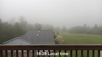
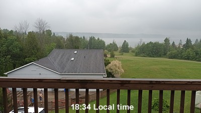
There was mist and low marine cloud over Wiarton and so we had to wait patiently
for it to clear... Thunder Bay was reporting Sky Clear (SKC).
When the cloud base reached 600 feet AGL we were out of there, and clear of the low cloud before we reached the end of the peninsula. Then we were able to climb to a comfortable altitude to fly along the islands in Lake Huron to Sault Ste Marie.
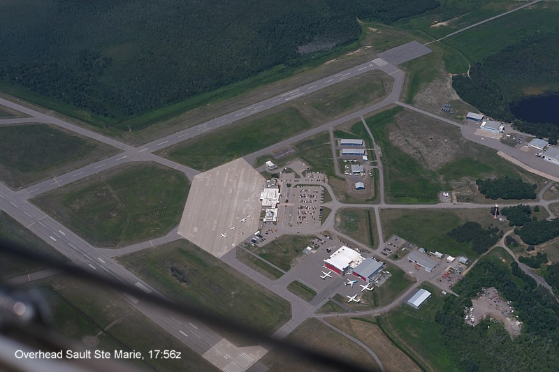
Over Sault Ste Marie we climbed to 6,500 feet to cruise
just off the American shore, Lake Superior, up to Thunder Bay.
For the longer legs we used the GFC700 Autopilot, cheating isn't it!
Total times: Takeoff 16:28z Land 19:58z, 3 hours and 30 minutes, 119.9 litres
was added equating to 34.25lt/hr, or 9 USG/hour.
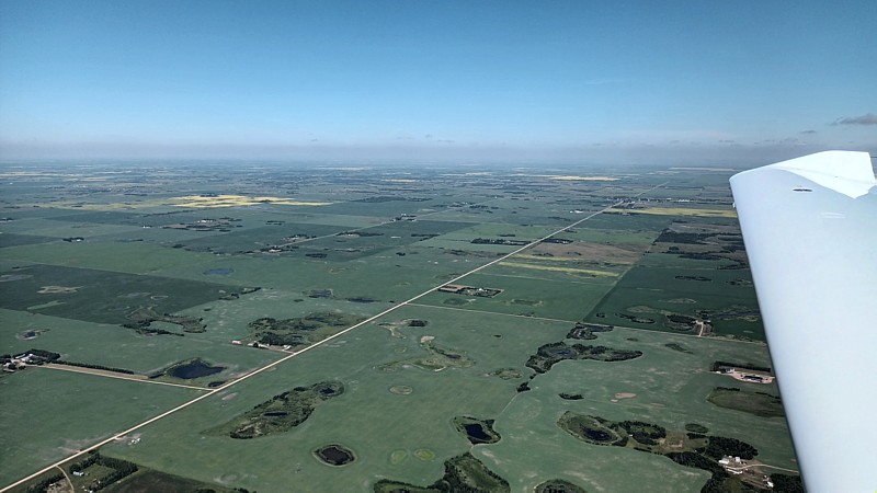
Next stop would be Winnipeg, and we were warned of a line of TCUs and CBs (Cumulo Nimbus) 25NM from Kenora and across our path. This is typical summer weather. These large mass clouds are easy to pick out and avoid, and usually have spaces between them through which a little aeroplane may weave its way. There is always the alternative to land enroute to let them pass you while you're safely on the ground.
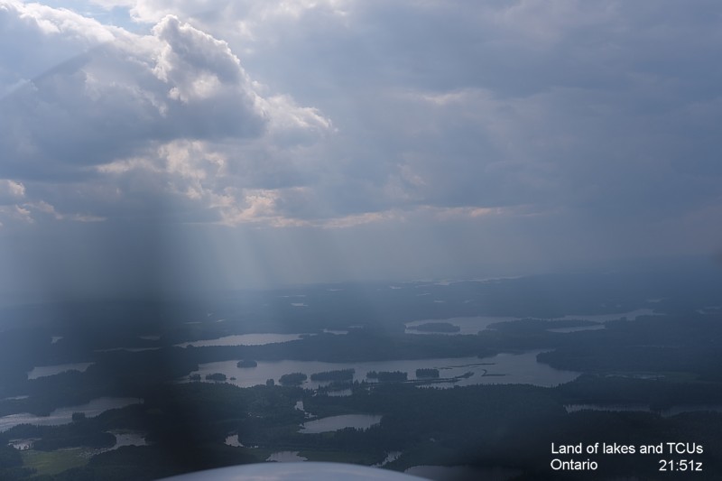
Enroute we did indeed meet the TCUs, and there was plenty
of space between them.
I put the map up on my iPad and followed our path the traditional way, finger on
the map. I was checking the accuracy of the moving map GPS of course.
When we were 28Nm to run to Winnipeg I made contact with the Tower and was
immediately told to descend below 2,500 feet as I was in Terminal Airspace or
something. This, if it exists, is not depicted on the map, nor on the GPS.
There is Mode C airspace below 12,500 feet ASL out at that distance and we were
compliant in this regard.
The weather was becoming seriously grotty just over Winnipeg Airport with rain
and incoming low cloud (this being a storm?) and so the runway light were on.
Wet runways are nice to land on.
Times were: Takeoff 21:14z and Landing 23:55z, 2 hours 41
minutes in flight.
Fast Air provided a ride to the nearby Birchwood Hotel, and we went across the
road for a pizza.
Winnipeg to Lethbridge via Regina
Tuesday 8th July, I woke up at 05:34
Manitoba time.
Downstairs at 08:00 Johnny was in a meeting with one of his business associates
who happened to be in Winnipeg. So I walked across the river to the Bluestone
Cottage Bakery for a good breakfast.
Half a quart of oil was added, but I didn't take note of
how much fuel we put in... The weather would not be a problem, but there would
be a prevailing headwind.
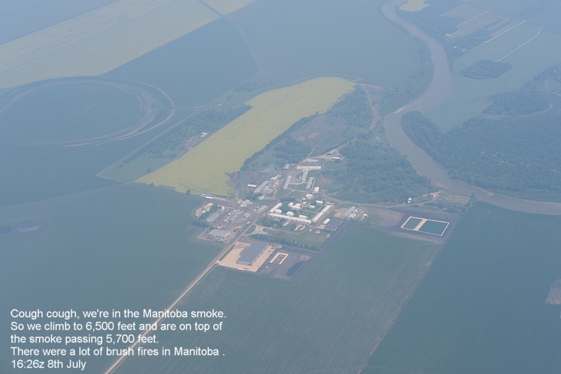
Initially we flew west at 4,500 feet, this made one's chesty cough begin, and so
it was up to 6,500 feet to be above the smoke from Manitoba's wild fires. The
top of the smoke layer was 5,700 feet ASL, and I relayed this to ATC.
Later we'd climb to 8,500 feet ASL.
Takeoff from Winnipeg was at 16:18z and we landed at
Regina at 18:39z. 80.5 litres of Avgas was added.
I added a Coffee Crisp from the vending machine to my stomach.
We'd left the smoke behind well before Regina and so it
was plain sailing to windy Lethbridge while insects plastered the aeroplane.
I contacted Moose Jaw where there was military training happening as we passed
to the north of their zone.
During these flight I take note of the times I which fuel tanks, and I get
updates from automated weather stations.
At Lethbridge we were straight in for runway 24.
After landing I borrowed a bucket, soap and a cloth to wipe the many insects off
the aeroplane. These insects ride the thermals to great heights in order to
splat against the aeroplane.We took a taxi to a hotel, and walked across the
road to have Vietnamese Pho.
naughty me, I didn't take any pictures at Lethbridge, sorry.
Takeoff from Regina was at 20:06z and landing at Lethbridge was at 22:53z, 2
hours 47 minutes in the air.
Lethbridge to Nelson
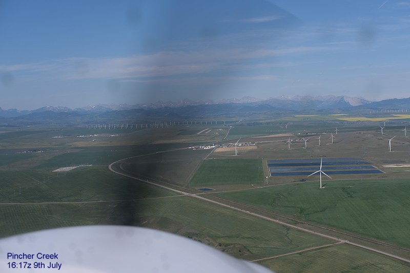
Insects galore committed suicide on the windscreen as we
made out way toward Pincher Creek and the entrance to the Crows Nest Pass.
We cruised towards the mountains at 6,500 feet ASL, and this would have to
change.
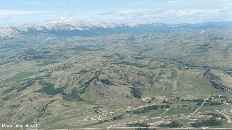
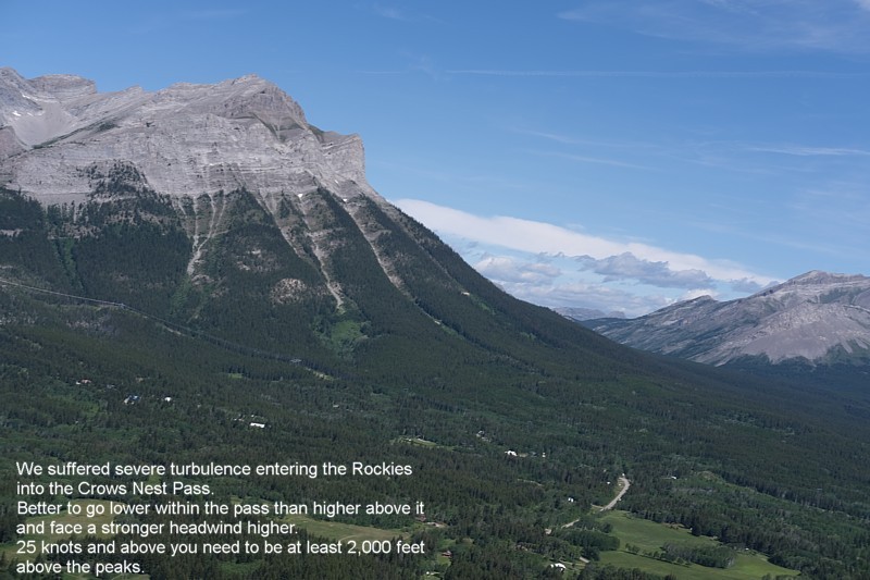
We hit serious turbulence as we entered the pass, go up
or go down? Those are your choices. In the valley the winds reduce in speed, to
be above it all means climbing high, very high. So we descended down to 5,000
feet, and rode it out.
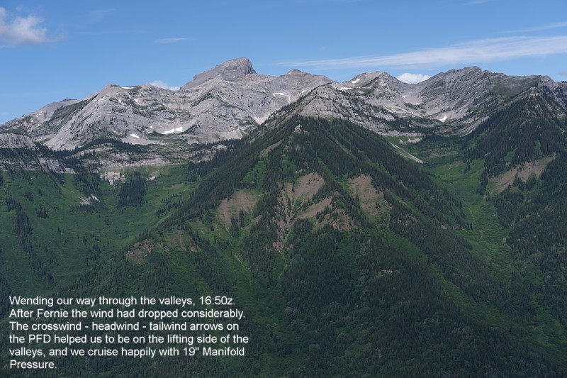
By Sparwood the turbulence had reduced to moderate, and beyond the Fernie gap it
was light.
After the Fernie Gap I made a Pirep (Pilot Report) to the Flight Information
Centre (FIC/FSS) and then heard this report re-broadcast to all that may be on
the common frequency (126.7).
The headwind, tailwind, crosswind, vectors on the G1000 PFD (Primary Flight
Display) give you a good indication of which side of a mountain valley you
should fly.
In these valleys with the lift available we cruised with low power set, 19"
manifold pressure. This saves a lot of petrol.
Takeoff from Lethbridge was at 15:54z and landing at Nelson was at 18:10z., 2 hours and 16 minutes in the air.
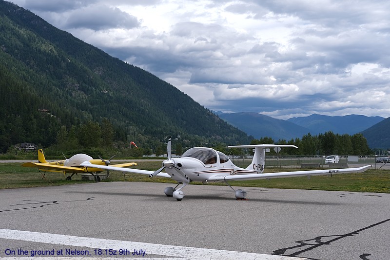
After landing it was time to walk into town for lunch.
Busaba Thai food had moved to a new larger more modern location which meant it's
quaintness was lost, but they still did good Thai food.
On the walk back we stopped by a hardware store and picked up a small bucket,
cloths, and hand soap so that I could clean the Alberta mass suicide off the
aeroplane.
An Indian (Asian) sales attendant there picked up on my British accent and we
exchanged humorous comments that most Canadians would never understand. She
commented on the lack of sense of humour...
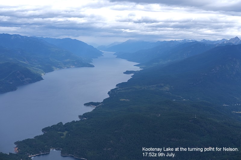
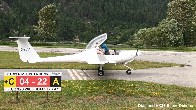
At Nelson Airport Eric took his mother in law up for a flight in his Diamond touring motor glider... He does not waste too much time on the ground, prefering to be in the air, and so afterwards he invited me to go for a flight.
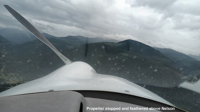
According to Sky Demon were reached 9,600 feet ASL above
Nelson, working the limited amount of ridge lift.
We flew around a bit and then Eric switched the engine off and feathered the
propeller.
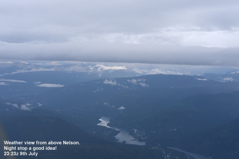
We were airborne for 42 minutes in the Super Dimona, most of that with the engine off. It was off for the landing as well, and we rolled towards his parking spot.
I like Nelson, it's one of my favourite places, and the
most interesting place is the classic Hume Hotel where I have stayed before
during my cross Canada trips.
That evening Sebastien turned up to have a drink with me. He is French from
France, and used to work with us at Sea Land Air where I was the Chief Flight
Instructor.
Nelson to Boundary Bay via Penticton
In the morning Johnny and I had breakfast in the Hume
Hotel and prepared to carry on to Boundary Bay.
The weather was reported to be dodgy over Hope, and low cloud obscured
Abbotsford further on so we waited a while before filing a flight plan and
obtaining a transponder code for the Lower Mainland.
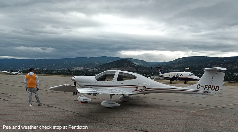
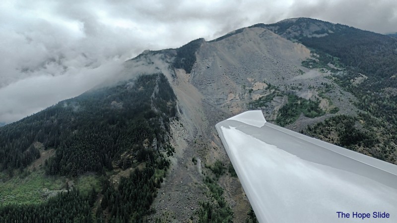
As you can see, the clouds met some of the mountain tops,
but it was still and easy passage to Penticton where the need for a pee was
convenient for a further weather check before proceeding towards Hope via the
low level route.
We added 111 litres of fuel at Penticton, (29.3 USG) the tanks hold 189 litres
(50 USG) though it is difficult to fill them to this level.
I reset the fuel totaliser to 50 USG, and then reduce the total to 48 USG.
The engine used around 9 USG per hour.
Takeoff from Nelson was at 16:11z and we landed at Penticton at 17:15z; 1 hour
and 4 minutes in the air.
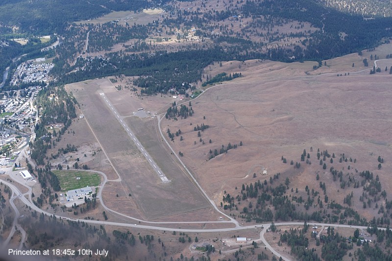
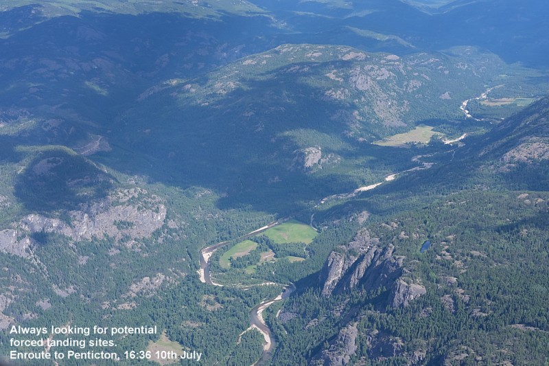
After nearly an hour on the ground we departed Penticton and overflew Summerland enroute to Princeton. We climbed to 5,600 feet and this enabled direct routing.
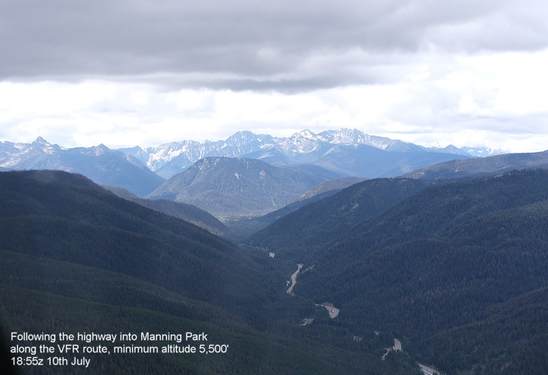
From Princeton onwards we expected a lowering cloudbase and so selected the low level VFR route to Hope.
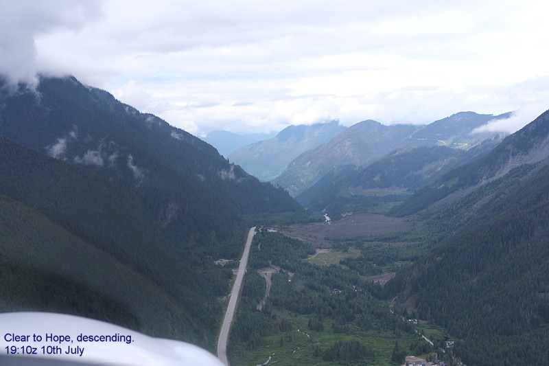
It was an easy flight down the valley and with Hope just around the corner a descent was made to 3,000 feet ASL.
Then it was into the busy training airspace of the Lower
Mainland, spotting traffic and with the Traffic Awareness system giving aural
warnings about aircraft in our vicinity.
We flew south of the Glen Valley, approaching overhead I said hello to Elizabeth
in Langley Tower.
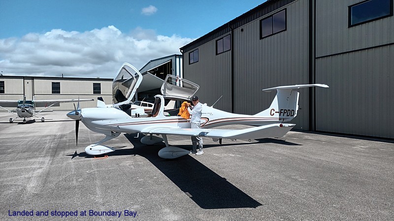
We flew the Court House approach procedure to land at Boundary Bay.
Takeoff time was 18:22z, and we landed at 19:56z for 1 hour and 34 minutes in the air.